- Important fix for a long term bug that was recently discovered. If you have used the DMS (Degrees, Minutes, Seconds) format to save a radius, some error was introduced. There is a way to 'undo' this error in about 98% of cases. (read more)
- Removed Catalan language.
- On the map, prevented the long press 'how you add a new pin' from traveling through views in the foreground.
For example long pressing the edit button here:
|
would be treated like adding a new pin. This was also applied to the 2 bars along the edges of the map page.
Full Version:
- Added a 'Custom message header' and a 'Custom message footer'.
- Fix to prevent a rare crash when importing kml files. I suspect that this is a cloud service bug. For example, user selects file to import, but has no data connection. File is not on local device, file system can't find file, and passes a null string to this app which causes the crash.
July 2017 update
- Added a 'Allow map rotation' setting that defaults to 'No'. Often when zooming the map, it would accidentally get rotated so that North is no longer up.
- Some layout changes for things that were just too small on a phone. Namely, the cells in the list are taller, the map scale indicator is larger, the buttons on the edit radius popup are large enough to click without frustration, and the tutorial/instructions that explain what each button on the map page does has much larger font.
- Fixed a bug that sometimes caused the map pin popover to not display the radius name. ie, only delete and edit buttons appeared.
February 2017 update
- Removed the GPS requirement to allow availability to Wi-Fi only iPad models that do not have a GPS receiver.
- Bug fix for iOS 8.x that caused a crash when the settings page was opened.
- Bug fix that caused the app to crash when searching for an area that was too large. Searching for 'Russia' or 'Canada' would cause this.
the following lists of model numbers are sorted
Wi-Fi only iPad models without GPS:
A1219, A1395, A1416, A1432, A1458, A1474, A1489, A1538, A1566, A1584, A1599, A1673
Wi-Fi + cellular iPad models with a satellite GPS receiver:
A1337, A1396, A1397, A1403, A1430, A1454, A1455, A1459, A1460, A1475, A1476, A1490, A1550, A1567, A1600, A1652, A1674, A1675
January 2017 update
- Created this page
- Corrected some of the new setting options that were not functioning properly namely 'Email to autofill' and 'Phone to autofill'
- Added geocoding and reverse geocoding on the map page.
- 'Email to autofill' and 'Phone to autofill' settings can now be imported from contacts.
- Faster list page scrolling and map load times.
- Corrected some .kml formatting issues, mainly the 5 XML special characters ' " > < &
- Kml files are now named with a human readable time stamp in the form of YYYY.MM.DD_HH.MM.SS rather than milliseconds since 1970. Example:radii_2016.12.27_18.48.58.kml instead of radii_1482459732.kml
- Faster application open time and tab switching. Radii are kept in memory rather than reading from the database and only saved to the database when needed (The slow I/O work is done on a secondary thread). Lazy load some button icon images. Much faster font scaling algorithm (though this only took a few milliseconds before, it's used almost everywhere and is at least 10 times faster)
User Guide
|
Map Page
|
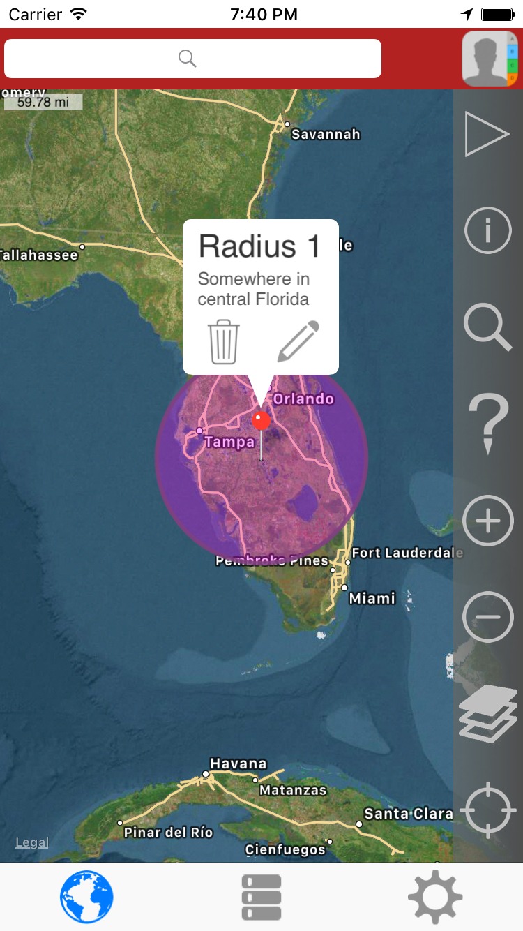
How the map page may appear:
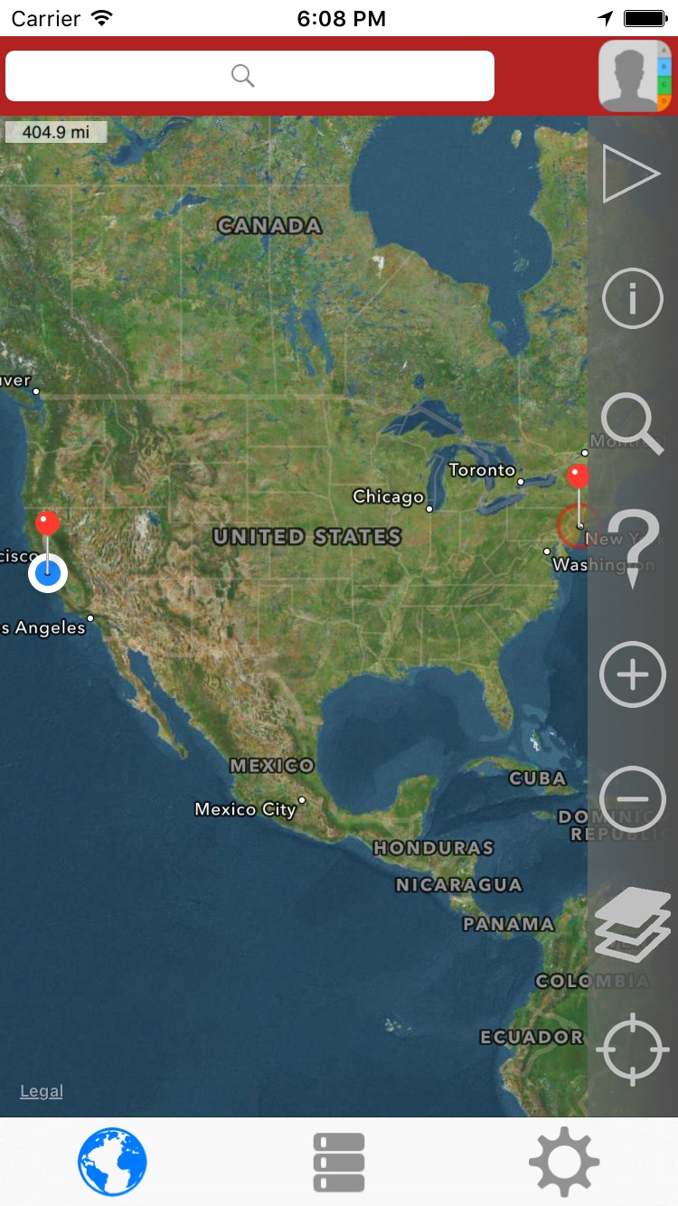
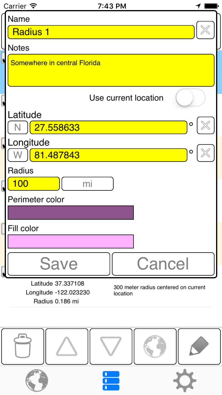
To add a new radius, long press on the map and a popup dialog will appear. Optionally, enter some notes, change the name, etc.
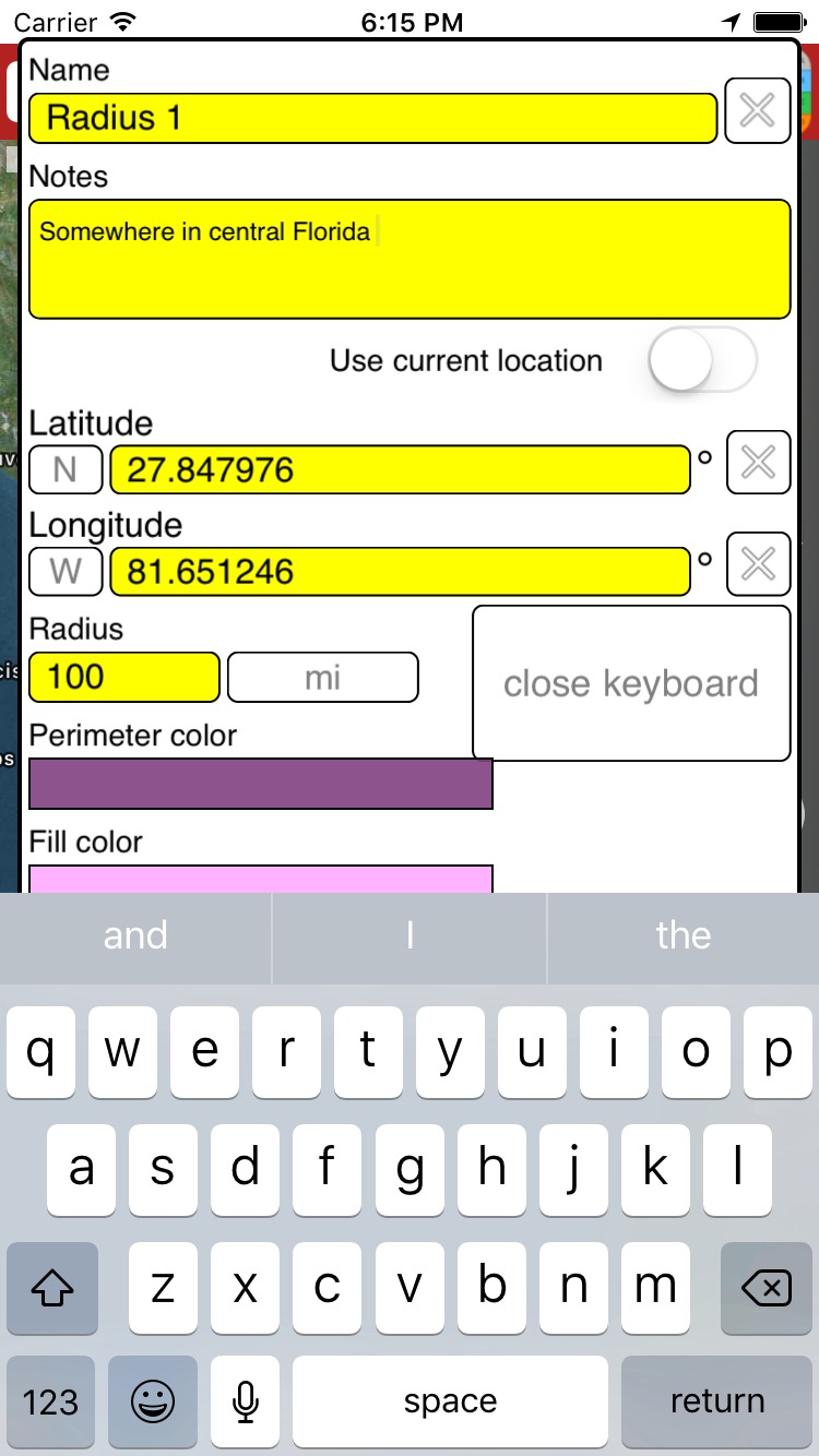
On most phones, the keyboard covers the bottom buttons, and you need to press the 'close keyboard' button so that you may press the Save or Cancel buttons.
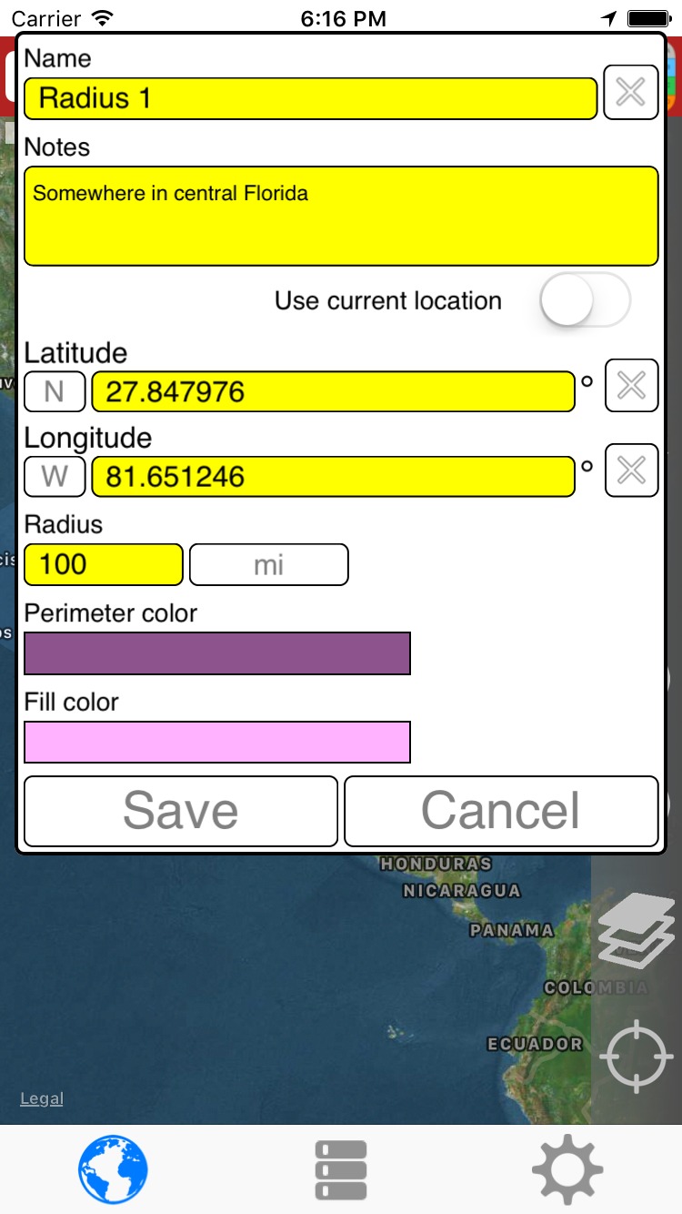
After pressing the Save button.
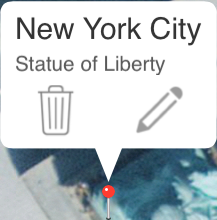
The newly added radius becomes the 'selected' radius. The selected radius has the callout view above it displaying it's name, notes, etc. Only one radius may be selected at a time.
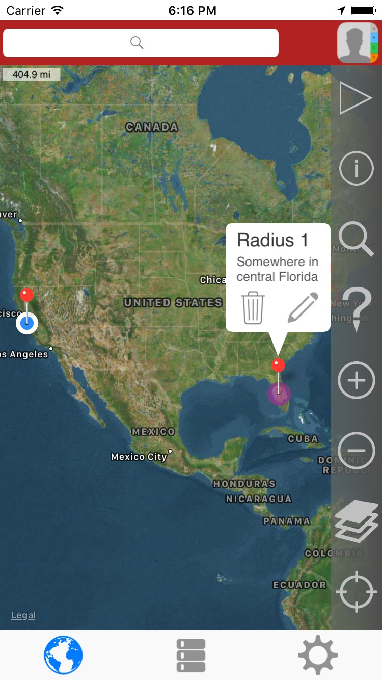
Dragging a radius
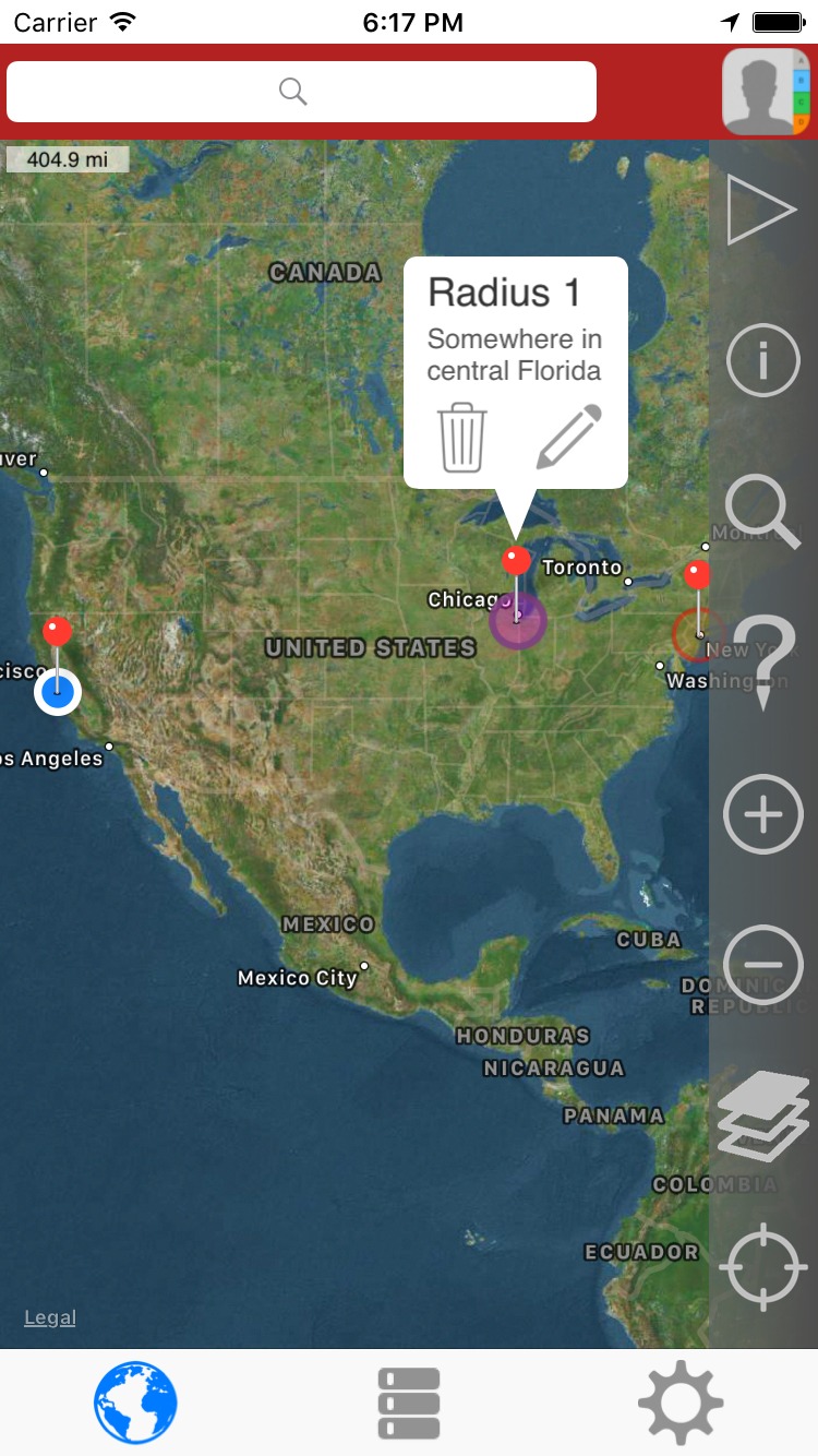
To drag a radius, it must be selected like in the image above. By pressing on the pin, the pin will float up so that you can see it under your finger. In this image, my finger is still on Florida, but note that the pin is now near Toronto.

Move your finger to drag this pin and drop it wherever you want, for example, near Chicago.
Since the description no longer makes any sense, I moved the pin back to Florida.
Geocoding
There are two types of geocoding:
- Forward geocoding converts an address into coordinates.
- Reverse geocoding converts coordinates into addresses.
Forward geocoding (Find point(s) for an address).
Reverse geocoding (Find addresses near a point)
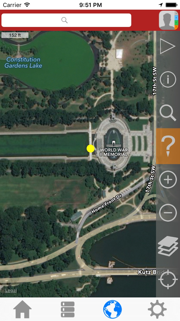
1) In this example, the yellow dot near the center of the map is where we will click.
Note the the '?' icon on the sidebar has been toggled and is shaded orange.
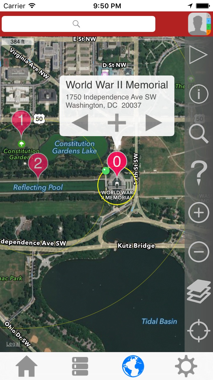
2) After clicking on the point of interest, the map has zoomed out some to show some potential result markers.
In this case, there are 3. They are labeled (0,1,2) and are ranked with the lowest number being the most probable result.
A green map pin indicates where you clicked.
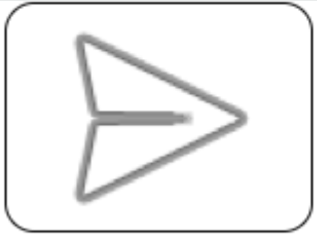
3) By clicking the > arrow, you can advance to the next result.
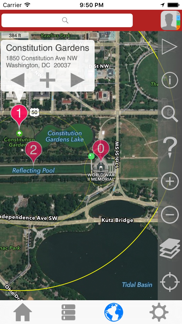
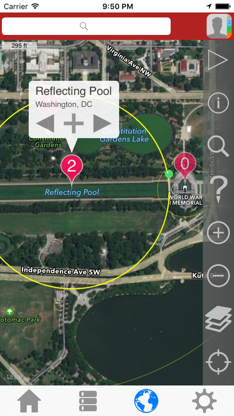
4) Clicking the > arrow again displays the last of the 3 results. Note that each result has a radius associated with it and is indicated with a yellow circle that becomes more pronounced when selected.
To remove the results from the map, press the '?' button on the side bar.
Press the '?' button one more time to toggle back to normal map mode. (so that clicking the map won't result in a reverse geocoding)
|
List Page
|
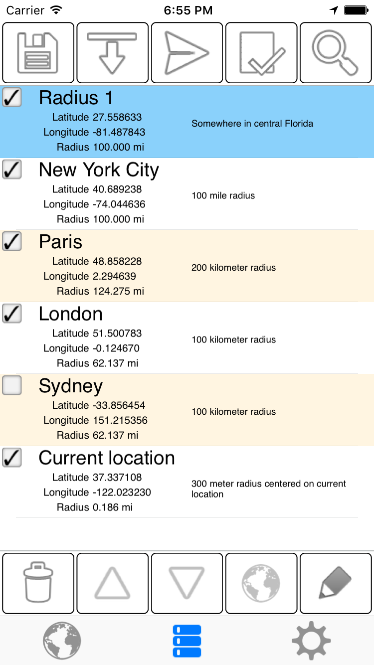
How the list page may appear:
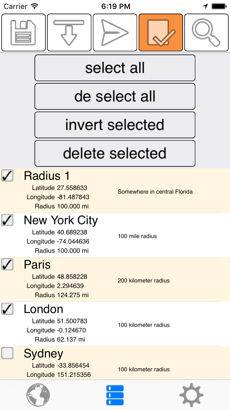
The radius tinted blue is the 'selected' radius. As on the map page, only one radius may be selected at a time.
If no radius is selected, the bottom row of buttons will hide.
Only radii that are checked will appear on the map.
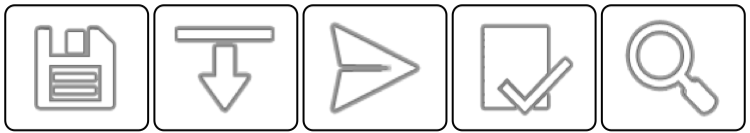
The top bar buttons from left to right.
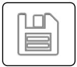
Save a .kml file to cloud storage. Note that only checked radii are included in the kml file and shown on the map. In this screenshot, Sydney will not be included in the kml file or shown on the map.
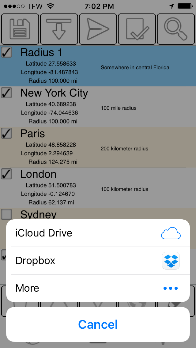
Select a cloud service. Note that you must have iCloud, Dropbox, or whatever cloud storage provider setup and enabled on your device.
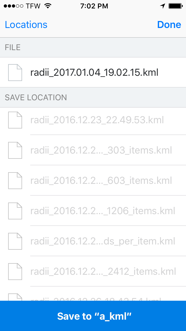
Dropbox selected. The file name is radii_2017.01.04_19.02.14.kml. This corresponds to the date and time: January 04, 2017 7:02 pm. Note the the format YYYY.MM.DD_HH.MM.SS ensures that file be sorted by date and time with standard alphabetical sorting.
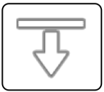
Import a .kml or .kmz file from cloud storage. Choose a cloud provider as before and select select a kml file to import.
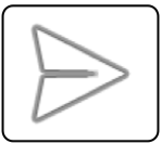
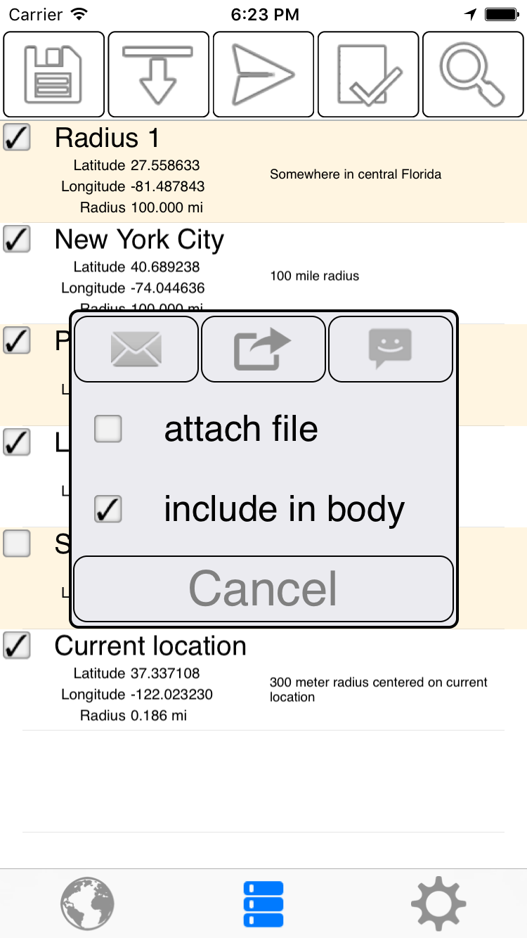
Share the checked radii.
'Include in body' means to list the human readable information and map link url in the body of the message. Note that there is a character limit as to how long a message body can be, so if you try to share something like 200 radii with 'include in body' checked, the app will most likely crash.
'Attach file' will attach the same kml file as shown with the Dropbox example.

Shows or hides 4 buttons. The first 3 check or uncheck cells in bulk. Note that only checked radii are shown on the map and exported when you share via email or save a file.
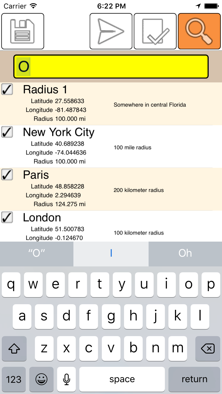
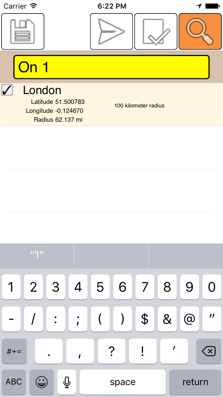
The Search function filters items in the list that contain a substring. Both the name and the notes fields are searched:
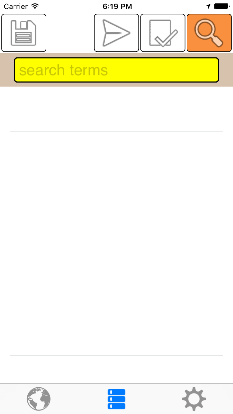
Entering 'O' returns all radii whose name or notes contain an 'O'
Note that this is NOT case sensitive.
'On' returns fewer results.
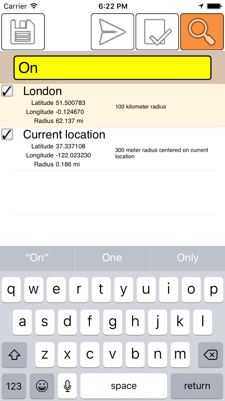
Separate search keywords with a space.
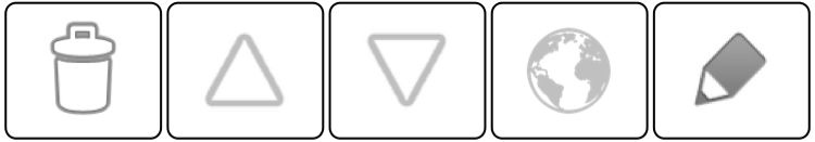
Each of the bottom bar buttons act on a single radius.
The bottom bar buttons from left to right:
Deletes the selected cell after showing a 'confirm delete' popup.
Move the selected cell up or down in the list. Long pressing will move the cell to the top or bottom of the list.
Opens the map page zoomed and centered on the the selected radius.
Edit the the selected radius.

|
Menu Popup and Settings
|
This is not a tab like the 2 others. Rather it opens a popup menu.
Email radius and Text message radius has a different function depending on which page you are on:
List Page: The radius in the selected list cell (if any) is used.
Map Page: The selected radius on the map (if any) is used.
Settings
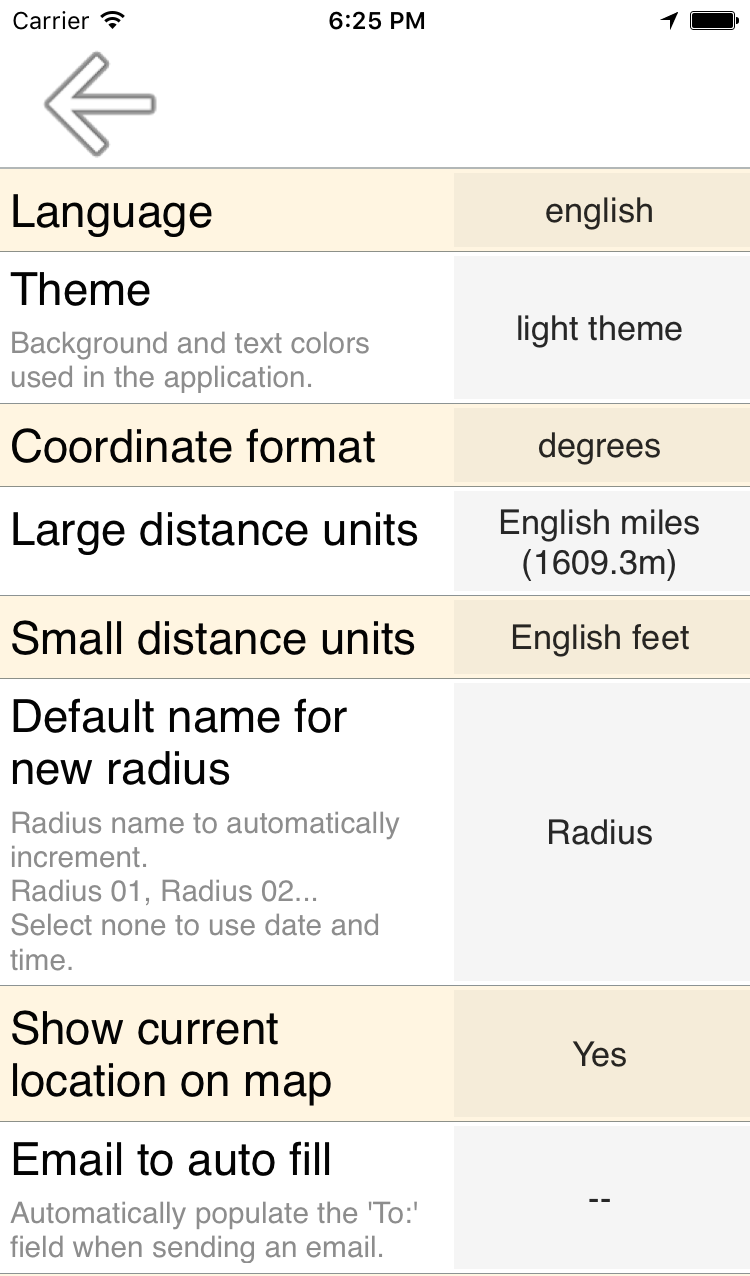
Language
This defaults to your device's language preference. If you are a non-native English speaker and you are reading this, you may want to set to English since the translations are probably are not the best.
Theme
Light or dark background.
Coordinate Format
Three Options:
- Degrees: 51.500780
- Degrees, Minutes, Seconds: 51° 30′ 2.81″ N
- Degrees, Minutes: 51° 30.0468′ N
Long distance units
Three options:
- kilometers
- miles (1609.34 meters)
- nautical miles (1852 meters)
Small distance units
Three options:
- meters
- feet
- yards
Default name for new radius
Instead of the default Radius 1, Radius 2, Radius 3,
you can replace 'Radius' with whatever you like. Each new default name will start numbering at 1...
Airport 1, Airport 2...
Email to auto fill
pre-fill the TO: field when preparing an email. This saves a few clicks if you usually send to the same email address. For multiple addresses, separate them with a comma as usual.
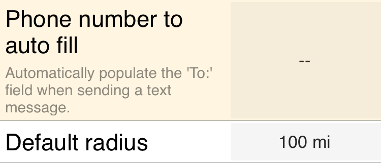
Phone number to auto fill
pre-fill the TO: field when preparing a text message. This saves a few clicks if you usually send to the same number.
Show current location on map
That's the blinking blue dot on the map.
Default radius
Default radius for new Radii.
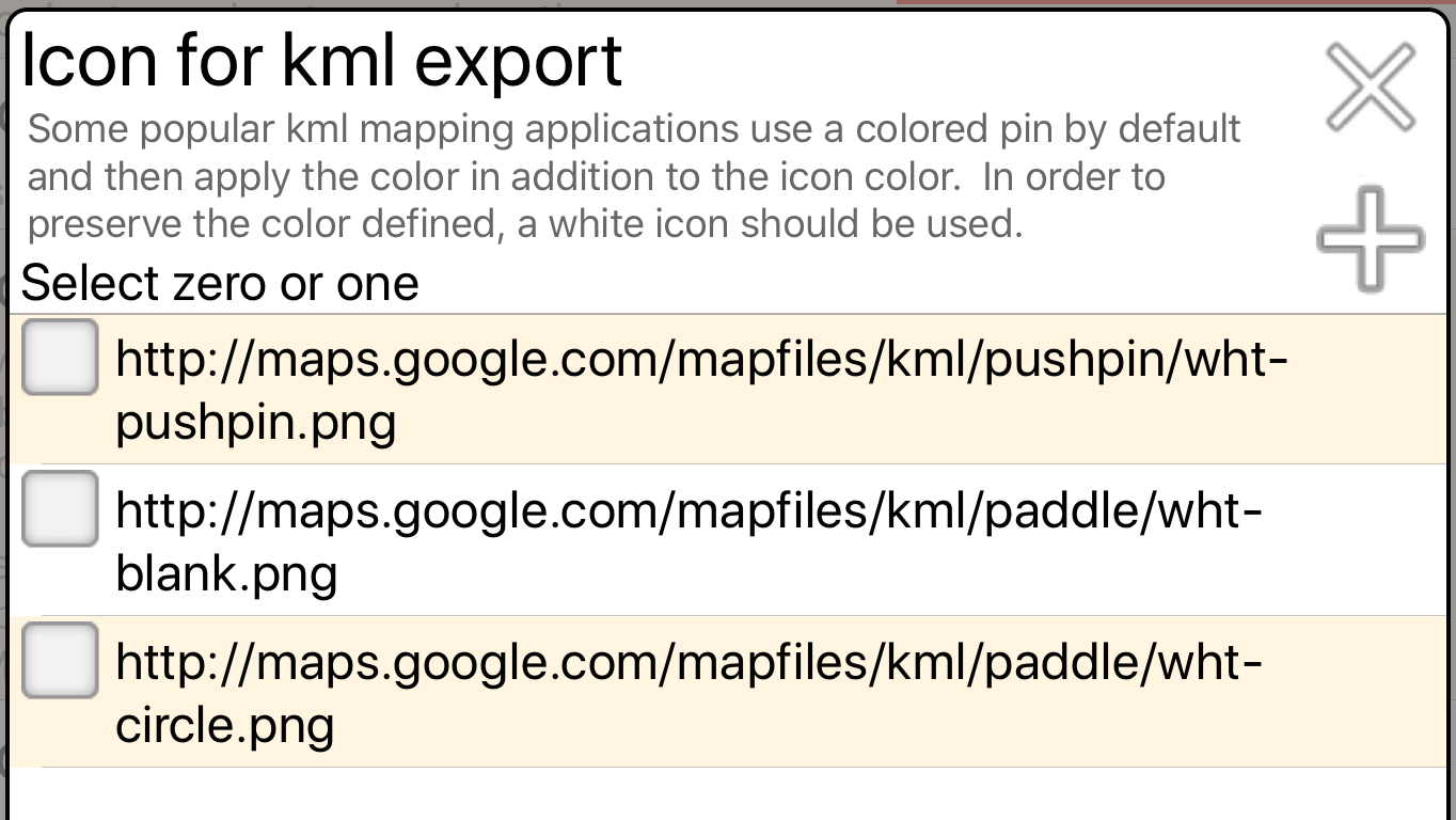
Preserving pin color when exporting to other applications
'Icon for kml export' setting.
To preserve the pin color in other applications, a white icon may need to be used. For example, Google Earth™ forces the default yellow pushpin, so the color that you define in this app is applied to the ugly yellow pin. Blue becomes cyan, white becomes yellow, and orange shifts towards magenta. Changing the icon in Google Earth™ destroys the pin color entirely.
Frequently asked questions
Q Which Datum is used?
A WGS 84
Contact
Email:
kevinwillett80@yahoo.com
Please include 'Radius on Map (Apple)' in the subject.
If pertaining to the Mac version, please make that clear.
|