English: iOS support page
แนะ นำ
English: Introduction
คําแนะนําพื้นฐาน
English: Basic Instructions
การเลื่อนแผนที่
English: Panning the map
ซูมแผนที่
English: Zooming the map
การวาดเส้นทาง
English: Drawing a path
การวาดรูปหลายเหลี่ยม
English: Drawing a polygon
ระดับคําฟุ่มเฟือย
English: Verbosity levels
ตัวอย่างอื่น ๆ จากเวอร์ชั่น iOS
English: Other examples from the iOS version
- ตัวอย่างมอริเตเนีย (รูปหลายเหลี่ยมอย่างง่าย)
English: Mauritania example (simple polygon)
- ตัวอย่างนิวซีแลนด์ (รูปหลายเหลี่ยมที่ไม่เป็นสมาชิกร่วมกันหลาย)
English: New Zealand example (several disjoint polygons)
- ตัวอย่างยูทาห์ (หลายรูปหลายเหลี่ยมซ้อนกันภายใน)
English: Utah example (multiple nested inner polygons)
- ตัวอย่างหน่วยพื้นที่ที่กําหนดเอง
English: Custom area unit example
วิธีติดตั้งแอปพลิเคชัน macOS ใหม่
English: How to reinstall macOS application
วิธีแลกรหัสโปรโมชั่นสําหรับแอปพลิเคชัน macOS
English: How to redeem promo code for macOS application
ติดต่อ
English: Contact
แนะ นำ
English: Introduction
วัดถนน, สวนสาธารณะ, ที่ดิน, ประเทศ, ทะเลสาบ, ฯลฯ จากมุมมองดาวเทียม. คํานวณระยะทาง พื้นที่ และปริมณฑล
English: Measure roads, parks, land, countries, lakes, etc from a satellite view. Calculates distances, areas, and perimeters.
คุณสมบัติที่โปรแกรมนี้มีที่คู่แข่งส่วนใหญ่ไม่ได้
English: Features that this application offers that most competitors do not:
- เพิ่มระยะทางที่กําหนดเองและหน่วยพื้นที่
English: Add custom distance and area units.
- วาดรูปหลายเหลี่ยมภายใน ตัวอย่างเช่นพื้นที่ที่ดินที่มีร่างกายของน้ําออก
English: Draw interior polygons. For example, land area with bodies of water removed.
- เพิ่มจุดตรงกลางของเส้นทาง (ส่วนใหญ่เท่านั้นช่วยให้คุณสามารถเพิ่มไปยังจุดสิ้นสุดของเส้นทาง) คลิกขวาเพื่อแทรก
English: Add a point to the middle of a path (Most only allow you to add to the end of the path) Left click to add to the end. Right click to insert.
- สลับสองจุดในเส้นทางหรือรูปหลายเหลี่ยม
English: Swap two points in a path or polygon.
คุณสมบัติ
English: Features:
- ค้นหาตามรหัสไปรษณีย์ เมือง ที่อยู่ ฯลฯ
English: Search by postal code, city, address, etc
- ตัวเลือกเลเยอร์แผนที่ 3 แบบ
English: 3 map layer options
- ส่งออกและนําเข้าแฟ้ม .kml
English: Export and import .kml files
- การตั้งค่าจํานวนมากสามารถเปลี่ยนแปลงบนแผนที่โดยไม่ต้องป้อนการตั้งค่า
English: Many settings can be changed on the map without having to enter settings
- หมุดสามารถลากได้
English: Pins are draggable
- ชื่อ บันทึกย่อ และเขตข้อมูลสีสําหรับแต่ละเส้นทางและรูปหลายเหลี่ยม
English: Name, notes, and color fields for each path and polygon
- เส้นทางข้อความอีเมลหรือข้อความตัวอักษรและข้อมูลของรูปหลายเหลี่ยม
English: Email or text message path and polygon data
- 4โหมดเสียงของ ดูเฉพาะข้อมูลที่คุณต้องการดู
English: 4 verbosity modes. See only the information that you want to see.
โหมดการวาดภาพ3
English: 3 drawing modes:
- เส้น ทาง
English: Paths
- รูป หลาย เหลี่ยม
English: Polygon
- รูปหลายเหลี่ยมที่มีช่องว่างกลวงภายใน
English: Polygon with hollow spaces inside
ค่าที่แสดงสําหรับเส้นทาง
English: Values displayed for paths:
- ระยะทางรวม
English: Total distance
- ระยะทางที่เพิ่มขึ้นสําหรับแต่ละเวย์พอยท์
English: Incremental distance for each waypoint
ค่าที่แสดงสําหรับรูปหลายเหลี่ยม
English: Values displayed for polygons:
- ตั้ง
English: Area
- ปริมณฑล
English: Perimeter
- ระยะทางสําหรับแต่ละด้าน
English: Distance for each side
เพิ่มจุดไปยังเส้นทางหรือรูปหลายเหลี่ยมใน 1 ใน 3 วิธี
English: Add points to a path or polygon in 1 of 3 ways:
- แตะบนแผนที่
English: Tap on the map
- ป้อนพิกัดด้วยตนเอง (เพิ่มจุดด้วยวิธีการอื่นและแก้ไขละติจูดและลองจิจูด)
English: Enter coordinates manually (add point by another method and edit latitude and longitude)
- นําเข้าไฟล์ .kml
English: Import .kml file
หน่วยระยะทางเริ่มต้นรวมถึง
English: Default distance units include:
- กิโลเมตร
English: Kilometers
- Km
English: Miles
- ไมล์ทะเล
English: Nautical miles
- เมตร
English: Meters
- M
English: Feet
หน่วยพื้นที่เริ่มต้นรวม
English: Default area units include:
- ตารางเมตร
English: Square meters
- ตารางฟุต
English: Square feet
- ตารางหลา
English: Square yards
- ตารางกิโลเมตร
English: Square kilometers
- จัตุรัส
English: Square miles
- ไมล์ทะเลสแควร์
English: Square nautical miles
- เอเคอร์
English: Acres
- เฮคเตอร์
English: Hectares
รูปแบบพิกัด
English: Coordinate formats:
- องศา
English: Degrees
- องศานาที
English: Degrees Minutes
- วินาทีองศา
English: Degrees Minutes Seconds
- UTM (สารทรานสเวิร์ส)
English: UTM (Universal Transverse Mercator)
- เอ็มจีเอ็ม (ระบบอ้างอิงตารางทหาร)
English: MGRS (Military Grid Reference System)
คําแนะนําพื้นฐาน
English: Basic Instructions
การเลื่อนแผนที่
English: Panning the map
คลิกซ้ายค้างไว้ที่ใดที่หนึ่งบนแผนที่
English: Left click and hold somewhere on the map.
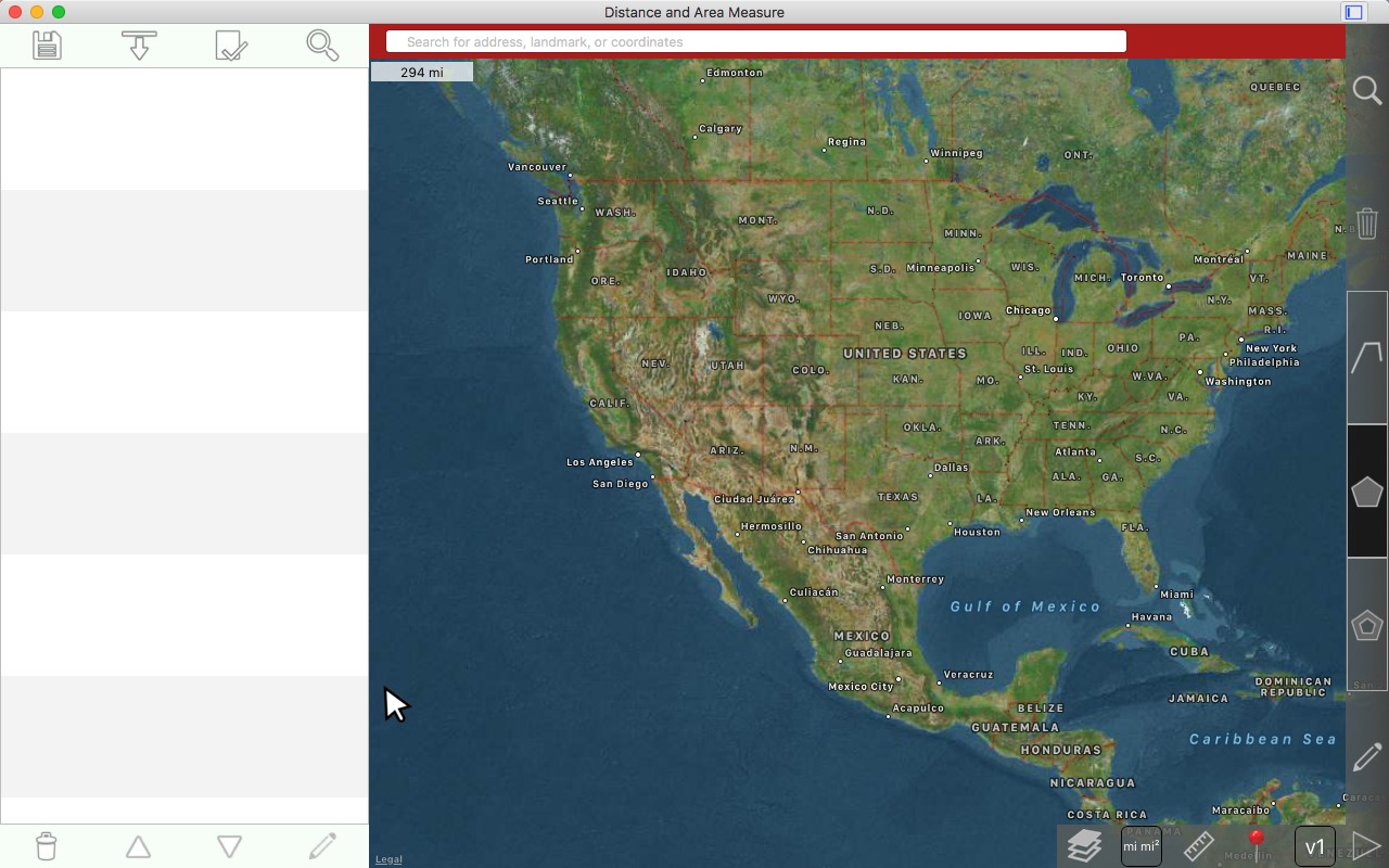
ในขณะที่กดปุ่มซ้ายของเมาส์ค้างไว้ให้ลากแผนที่ต่อไป
English: While holding down the left mouse button, continue dragging the map.
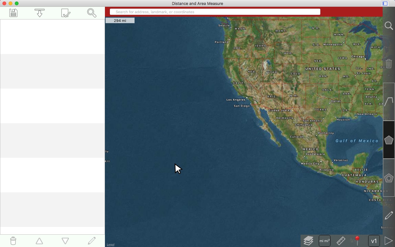
ปล่อยปุ่มซ้ายของเมาส์เมื่อเสร็จแล้ว
English: Release the left mouse button when finished.
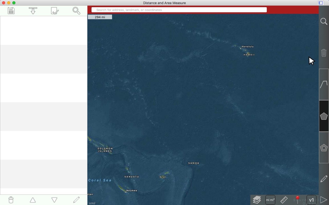
ซูมแผนที่
English: Zooming the map
ซูมล้อเลื่อนของเมาส์
English: Zoom the mouse scroll wheel.

การเลื่อนในเพิ่มเติม
English: Scrolling in more
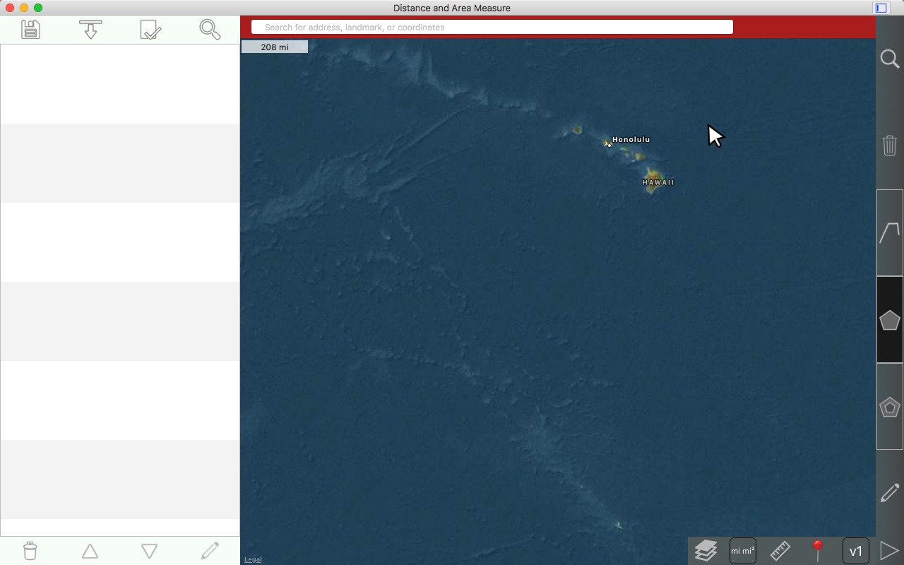
การเลื่อนในเพิ่มเติม
English: Scrolling in more
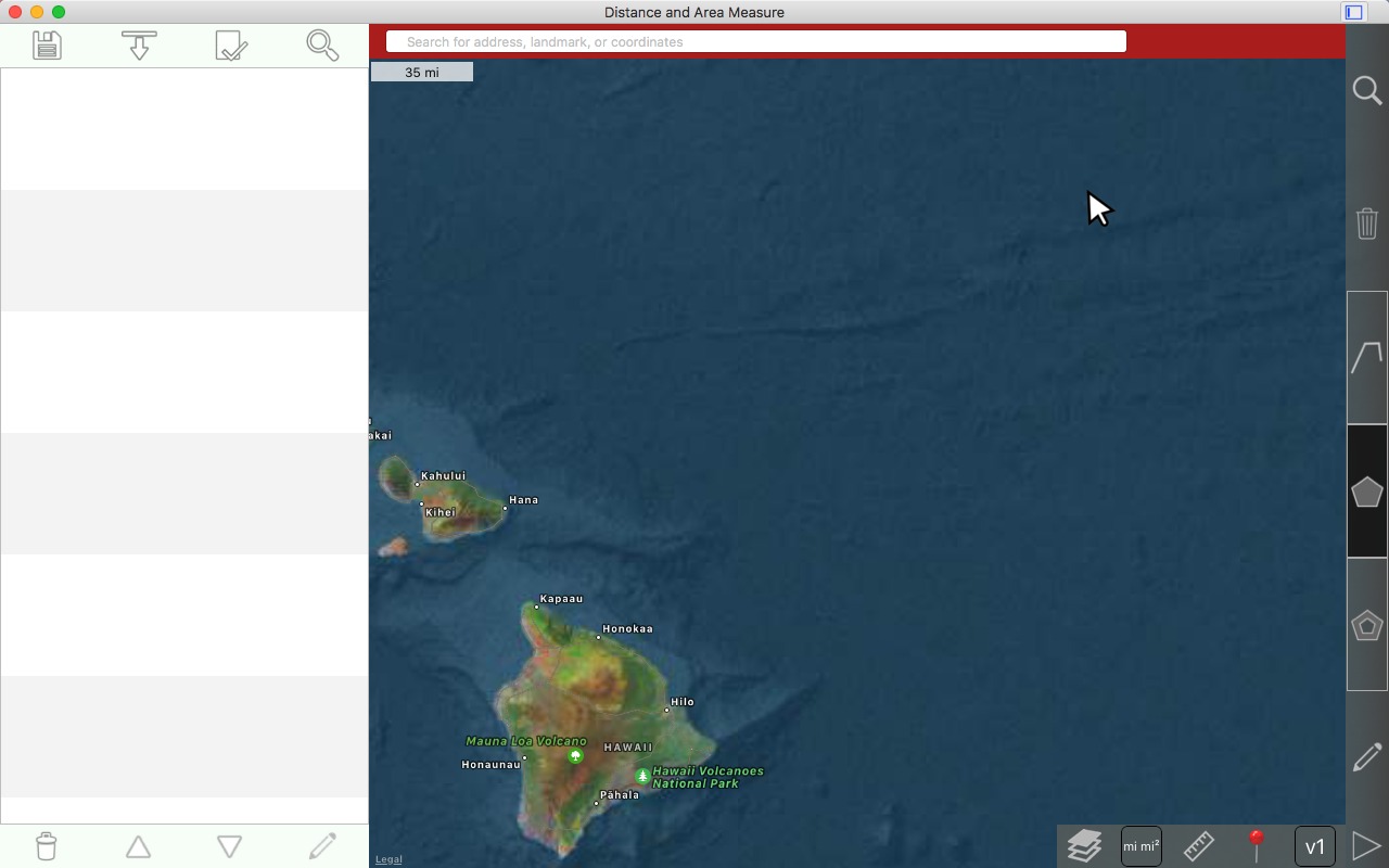
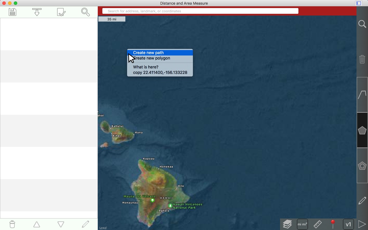
การวาดเส้นทาง
English: Drawing a path
คลิกขวาที่แผนที่ที่คุณต้องการวางขาที่ 1
English: Right click on the map where you want to place the 1st pin
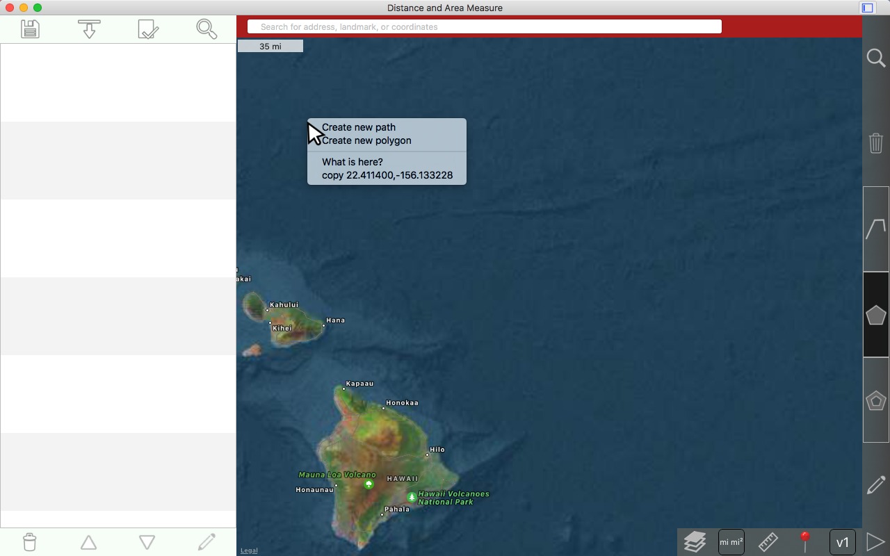
เลือก 'สร้างเส้นทางใหม่'
English: Select 'Create new path'
คลิกซ้ายเพื่อวางขาที่ 2
English: Left click to drop the 2nd pin
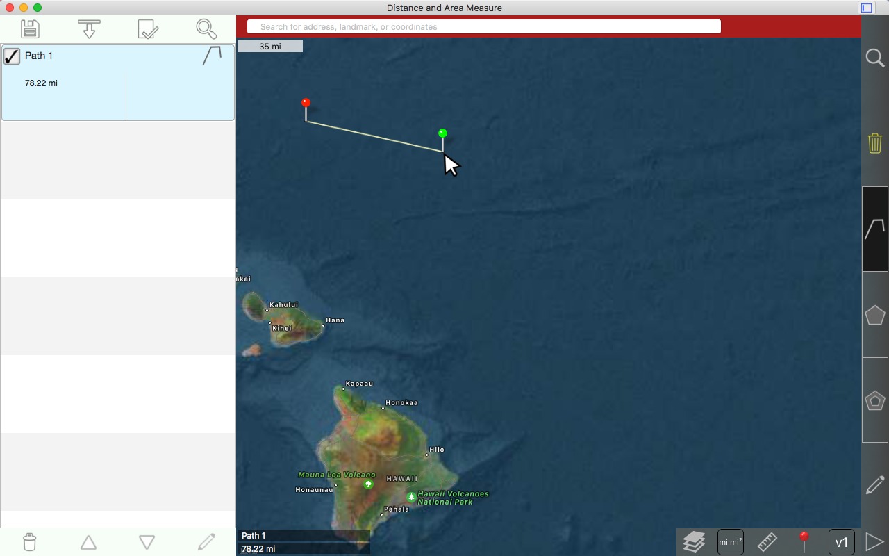
คลิกซ้ายเพื่อวางขาที่ 3
English: Left click to drop the 3rd pin

การลากหมุด
English: Dragging a pin
วางเมาส์เหนือหมุดที่คุณต้องการลาก
English: Mouse over the pin that you want to drag

คลิกซ้ายและปล่อยขาที่คุณต้องการลาก ขาจะกลายเป็นสีเขียว
English: Left click and release the pin that you want to drag. The pin will become green.

คลิกซ้ายค้างไว้ ขาจะเพิ่มขึ้น
English: Left click and hold. The pin will rise.

ขณะที่ยังคงกดปุ่มเมาส์ด้านซ้าย ให้ลากหมุด
English: While still holding down the left mouse button, drag the pin

ยังลากขาอยู่ กดปุ่มซ้ายของเมาส์ค้างไว้
English: Still dragging the pin. Continue holding the left mouse button.

วางขาโดยปล่อยปุ่มซ้ายของเมาส์ เส้นทางจะออกใหม่
English: Drop the pin by releasing the left mouse button. The path will redraw.

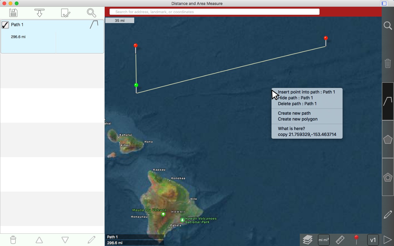
การแทรกหมุดในเส้นทาง
English: Inserting a pin in a path
คลิกขวาภายในเส้นทาง bounding กล่องและเลือก'จุดแทรกลงในเส้น'
English: Right click within the paths bounding box and choose 'insert point into line'.
ผล
English: Result

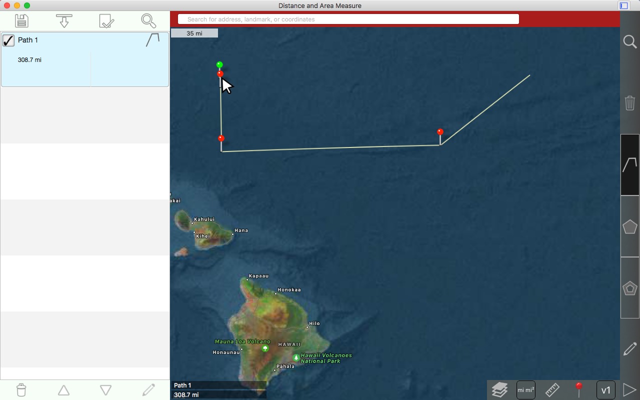
การสลับหมุด
English: Swapping pins
เลือกหนึ่งในหมุดที่คุณต้องการสลับโดยการคลิกซ้ายและปล่อย
English: Select one of the pins that you want to swap by left clicking and releasing

คลิกซ้ายค้างไว้ ขาขึ้นเหนือเคอร์เซอร์ของเมาส์
English: Left click and hold. The pin rises above the mouse cursor.

เริ่มลากหมุดไปยังขาที่คุณต้องการสลับด้วย กดปุ่มซ้ายของเมาส์ค้างไว้
English: Start dragging the pin towards the pin that you wish to swap it with. Continue holding the left mouse button.

วางขาไว้ใกล้กับขาอื่น
English: Drop the pin close to the other pin.
เลือก 'สลับทั้งสองหมุด'
English: Choose 'swap these two pins'
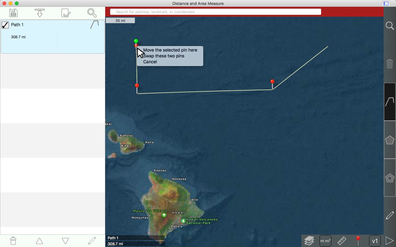
เลือก 'สลับทั้งสองหมุด'
English: Choose 'swap these two pins'
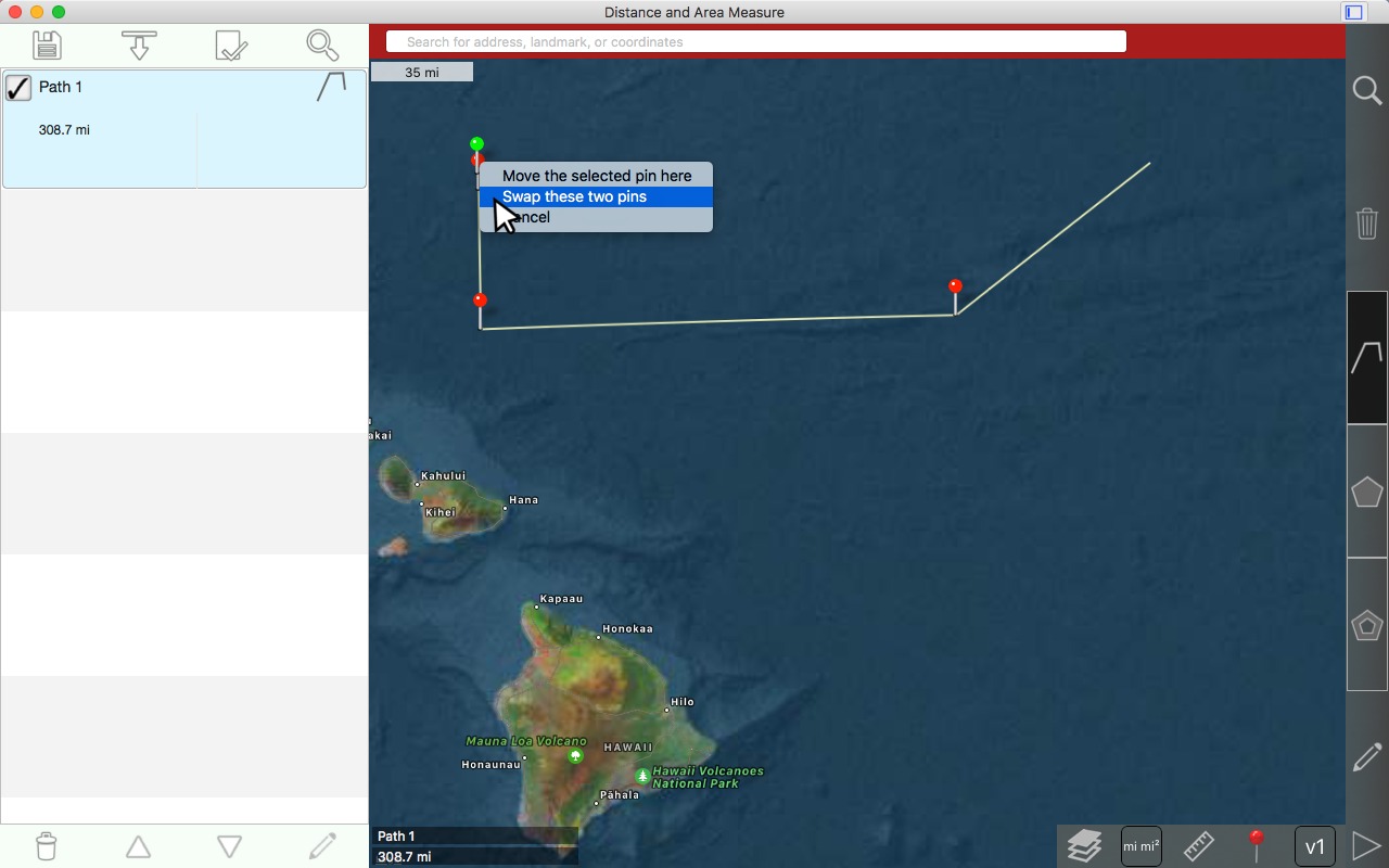
ผล
English: Result
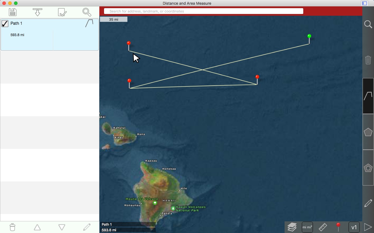
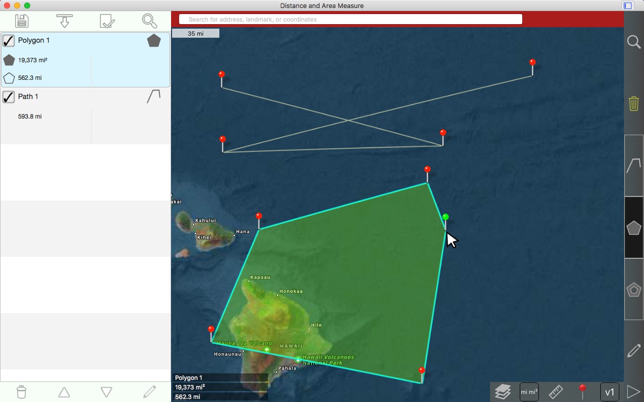
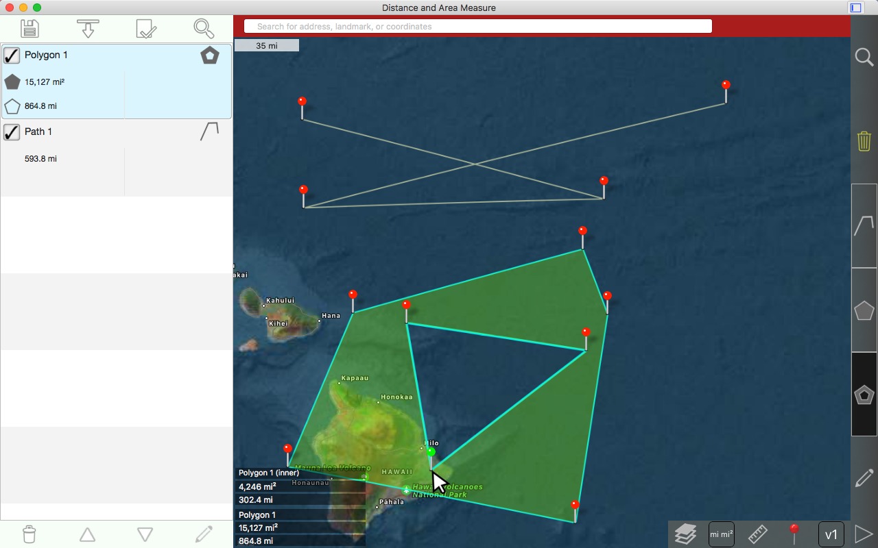
การวาดรูปหลายเหลี่ยม
English: Drawing a polygon
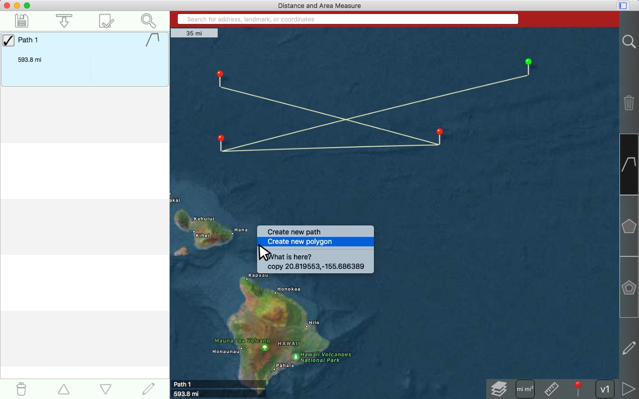
คลิกขวาที่แผนที่ที่คุณต้องการวางขาที่ 1
English: Right click on the map where you want to place the 1st pin
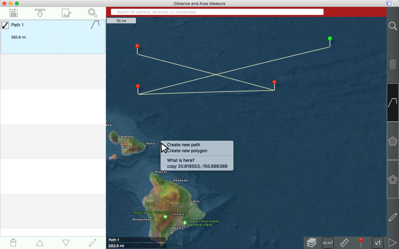
เลือก 'สร้างรูปหลายเหลี่ยมใหม่'
English: Choose 'Create new polygon'
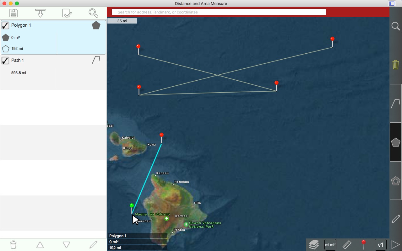
หมุดที่ 1 ถูกวาด
English: 1st pin is drawn

คลิกซ้ายเพื่อวาดขา 2
English: Left click to draw 2nd pin
คลิกซ้ายเพื่อวาดขาที่ 3
English: Left click to draw 3rd pin
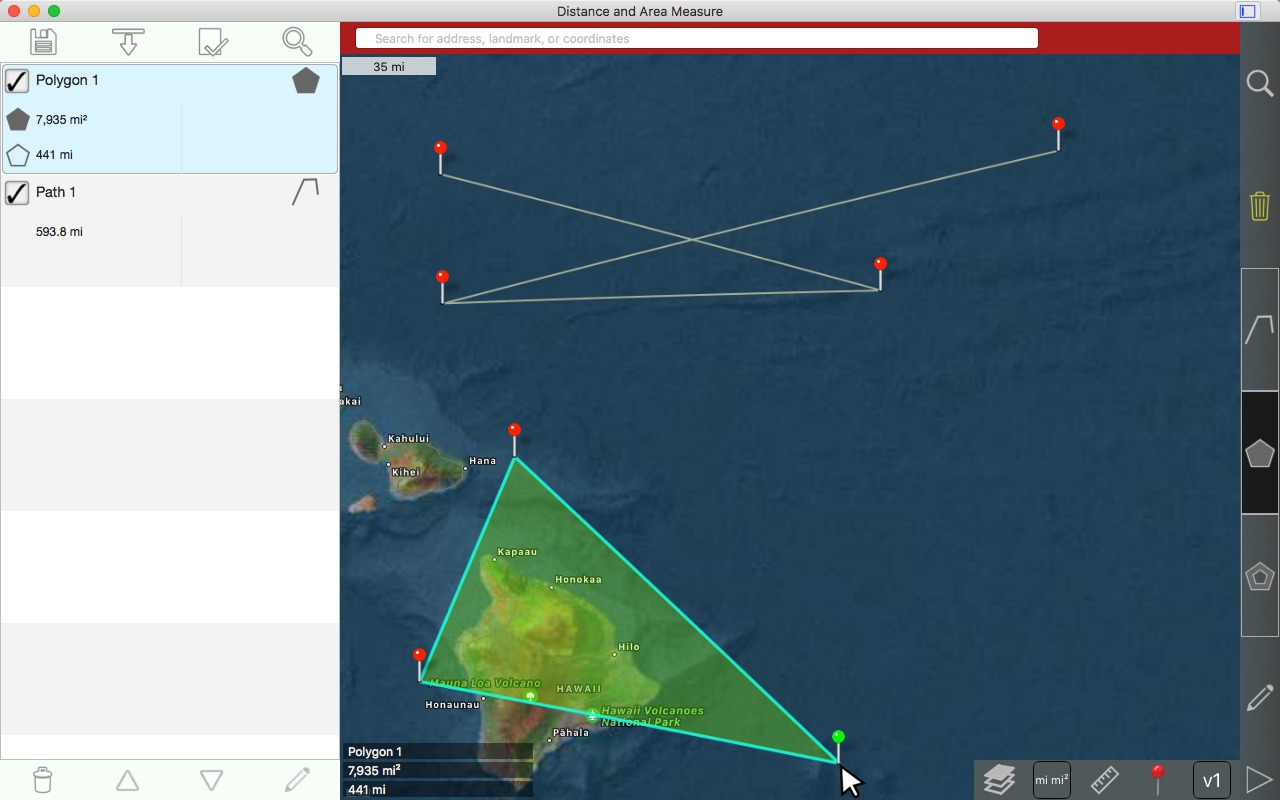
คลิกซ้ายเพื่อวาดพินที่ 4
English: Left click to draw 4th pin
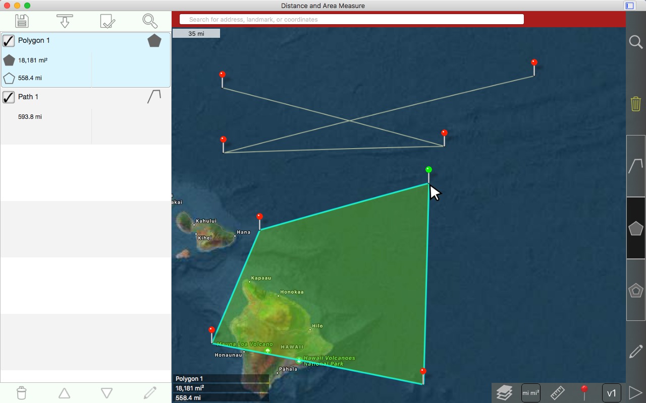
คลิกซ้ายเพื่อวาดขาที่ 5
English: Left click to draw 5th pin
การสร้างรูปหลายเหลี่ยมภายใน
English: Creating an interior polygon
รูปหลายเหลี่ยมแต่ละรูปหลายเหลี่ยมสามารถมีจํานวนใด ๆ ของรูปหลายเหลี่ยมภายใน
English: Each polygon can have any number of inner polygons.
โปรดสังเกตว่า รูปหลายเหลี่ยมด้านในสามารถทับซ้อนกันหรือไม่เป็นสมาชิกร่วมจากรูปหลายเหลี่ยมแม่ คุณต้องปิดใช้งานการตั้งค่าในการตั้งค่า ดูข้อมูลเพิ่มเติมได้ที่ 'ตัวอย่างนิวซีแลนด์'
English: Note that inner polygons can be overlapping or disjoint from their parent polygon. You must disable the setting in preferences. See the 'New Zealand example' for more information.
คลิกขวาในขอบเขตของรูปหลายเหลี่ยม
English: Right click in the polygon's boundaries.
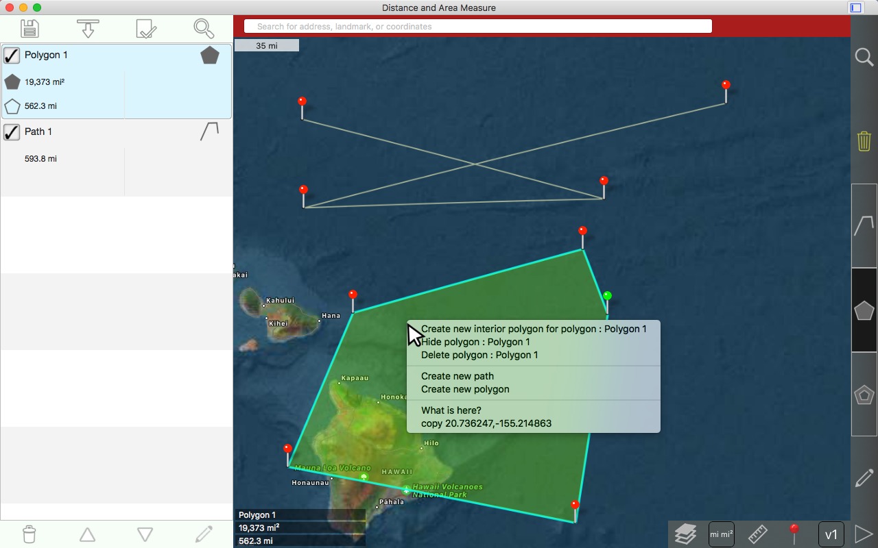
เลือก 'สร้างรูปหลายเหลี่ยมภายในใหม่'
English: Choose 'Create new interior polygon'

หมุดที่ 1 ถูกวาด
English: 1st pin is drawn
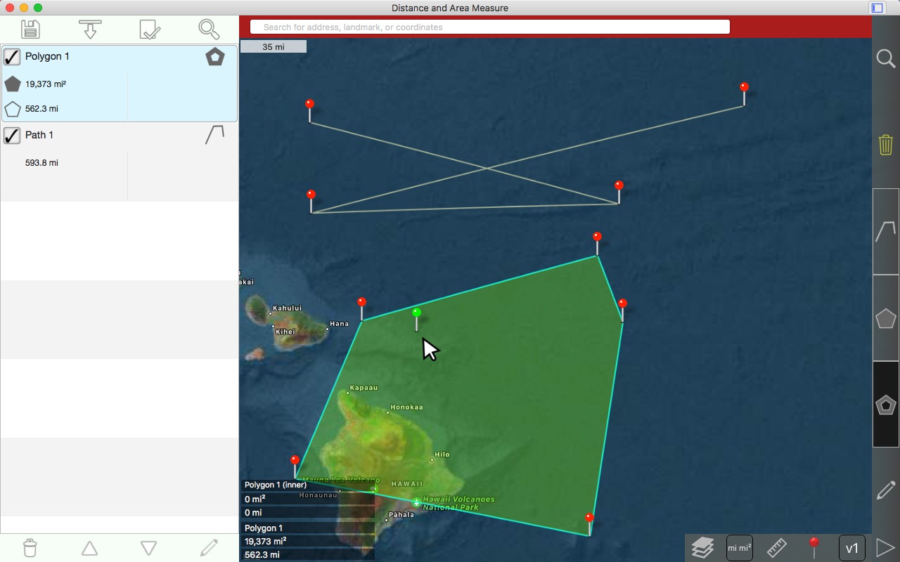
คลิกซ้ายเพื่อวาดขา 2
English: Left click to draw 2nd pin
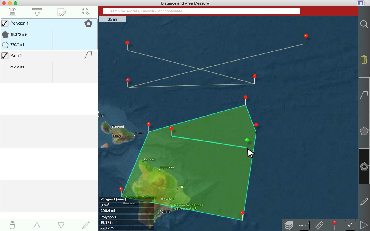
คลิกซ้ายเพื่อวาดขาที่ 3 โปรดสังเกตว่า พื้นที่ของรูปหลายเหลี่ยมได้ลดลงเนื่องจากพื้นที่ของรูปหลายเหลี่ยมด้านในจะถูกหักออก
English: Left click to draw 3rd pin. Notice that the area of the polygon has decreased because the area of the inner polygon is subtracted.
ระดับคําฟุ่มเฟือย
English: Verbosity levels
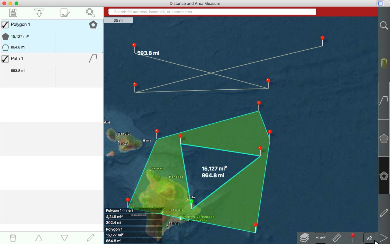
ระดับคําฟุ่มเฟือย 1: ข้อมูลแสดงเฉพาะที่มุมซ้ายล่างเท่านั้น
English: Verbosity level 1: Information only shown in bottom left corner.
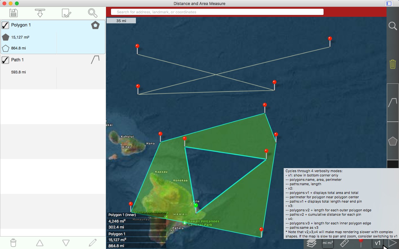
ระดับคําฟุ่มเฟือย 2:
English: Verbosity level 2:
เส้นทาง: ระยะทางรวมแสดงใกล้ขาสุดท้าย
English: Paths: total distance displayed near last pin
รูปหลายเหลี่ยม: พื้นที่ทั้งหมดที่แสดงใกล้ศูนย์กลาง
English: Polygons: total area displayed near center
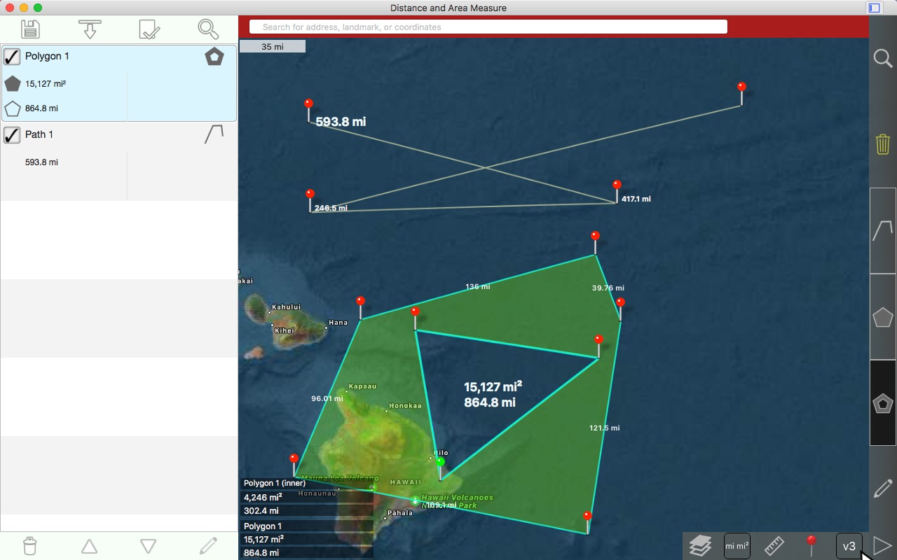
ระดับคําฟุ่มเฟือย 3:
English: Verbosity level 3:
เส้นทาง: ระยะทางที่เพิ่มขึ้นสําหรับแต่ละขา
English: Paths: incremental distance for each pin
รูปหลายเหลี่ยม: ความยาวของแต่ละด้านของรูปหลายเหลี่ยมด้านนอก
English: Polygons: length of each side of outer polygon
ระดับคําฟุ่มเฟือย 4:
English: Verbosity level 4:
เส้นทาง: ไม่มีการเปลี่ยนแปลง
English: Paths: no change
รูปหลายเหลี่ยม: ความยาวของแต่ละด้านของรูปหลายเหลี่ยมด้านใน
English: Polygons: length of each side of inner polygons

ดาวน์โหลด
English: Downloads:
utah_and_new_zealand_polygon_examples.kml
ติดต่อ
English: Contact
Email:
kevinwillett80@yahoo.com
Please include 'Distance and Area Measure (Mac)' in the subject.
โปรดทราบว่าส่วนรีวิวของหน้าร้านค้าของแอปไม่ใช่ที่ที่ถามคําถาม นักพัฒนาจะไม่ได้รับแจ้งเมื่อมีการแสดงความคิดเห็น อาจเป็นเวลาหลายเดือนก่อนที่นักพัฒนาซอฟต์แวร์จะมองเห็นคําถามของคุณ
English: Please note that the review section of an app's store page is not the place to ask questions. Developers are not notified when reviews are posted. It may be several months before the developer sees your question.
English: Basic Instructions
การเลื่อนแผนที่
English: Panning the map
ซูมแผนที่
English: Zooming the map
การวาดเส้นทาง
English: Drawing a path
การวาดรูปหลายเหลี่ยม
English: Drawing a polygon
ระดับคําฟุ่มเฟือย
English: Verbosity levels
English: Other examples from the iOS version
English: Mauritania example (simple polygon)
English: New Zealand example (several disjoint polygons)
English: Utah example (multiple nested inner polygons)
English: Custom area unit example
English: How to reinstall macOS application
English: How to redeem promo code for macOS application
English: Contact
English: Introduction
English: Basic Instructions
English: Panning the map
English: Zooming the map
English: Drawing a path
English: Dragging a pin
English: Inserting a pin in a path
English: Swapping pins
English: Drawing a polygon
English: Creating an interior polygon
English: Verbosity levels
English: Contact