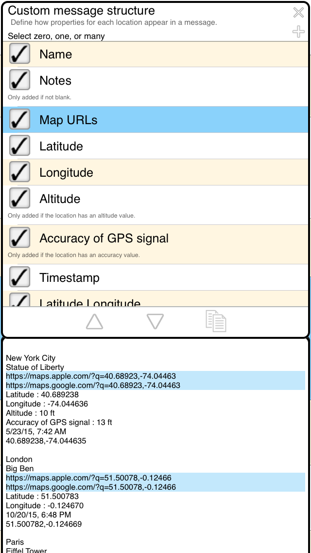
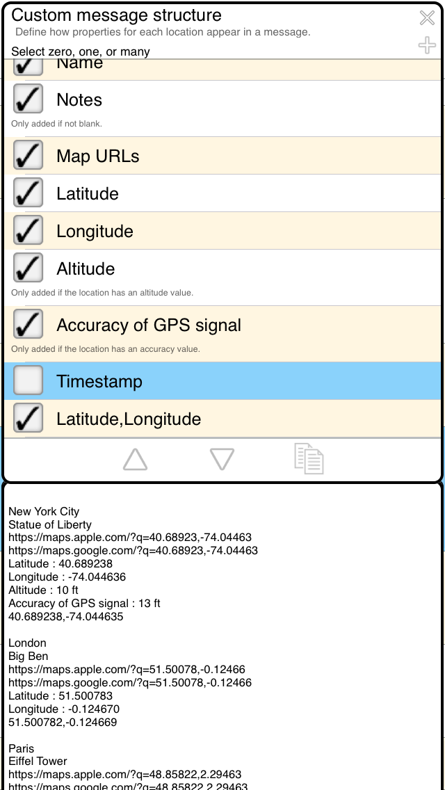

<mapUrls>
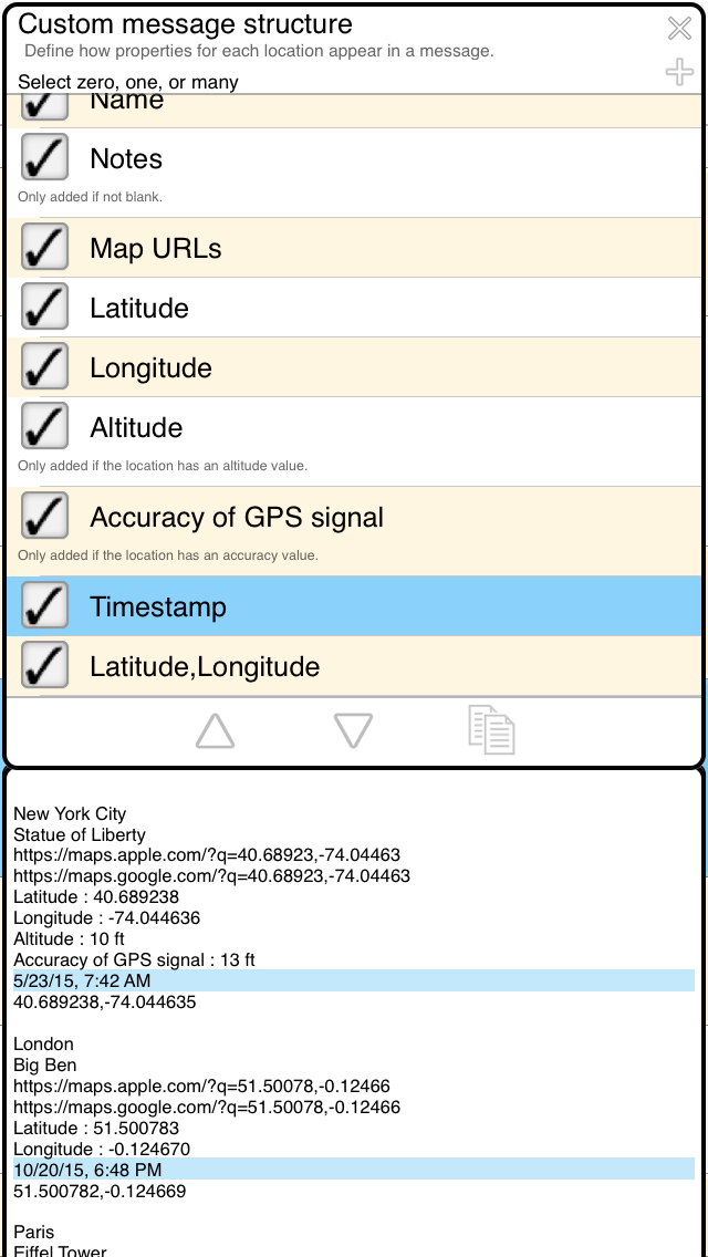
<timestampDeviceFormatShort> (timestamp based on your device settings)
<timestampMillisSince1970> Milliseconds since 1970
<timestampMillisSince1970WithMultD.dd> Mulitiply milliseconds by D.dd. For example 0.001 for seconds or 1000000 for nanoseconds
<altMetersWithMultiplierMultiplier> multiplier is what to multiply a meter by.
| structure string | output for 1000 meters | output for 1001 m | notes |
|
|
3281 feet | 3284 feet | --- feet |
|
|
39370 inches | 39409 inches | --- inches |
|
|
1 km (trailing zeros obmitted) | 1.001 km | --- km |
|
|
0.621 miles | 0.622 miles | --- miles |
|
|
1902 Egyptian cubits | 1903 Egyptian cubits | --- Egyptian cubits |
Optionally, you can define maxFraction, minFraction, and minInteger
<altMetersWithMultiplierMultiplier:maxFraction> maxFraction is the number of decimal places to round to. Above, maxFraction is automatically set to 1 meter precision.
<altMetersWithMultiplierMultiplier:maxFraction:minFraction> minFraction is the number of decimal places to force.
<altMetersWithMultiplierMultiplier:maxFraction:minFraction:minInteger> minInteger is the number of integer places to force.
| structure string | output for 1000 meters | output for 1001 m | notes |
|
|
3281 feet | 3284 feet | --- feet |
|
|
39370 inches | 39409 inches | --- inches |
|
|
1 km (trailing zeros obmitted) | 1.001 km | --- km |
|
|
1 km (trailing zeros obmitted) | 1.001 km | --- km |
|
|
1.000 km (minFraction forces trailing zeros) | 1.001 km | --- km |
|
|
1.00 km (minFraction forces trailing zeros) | 1.001 km | --- km |
|
|
1.00 km (minFraction forces trailing zeros) | 1.00 km | --- km |
|
|
001.00 km | 001.00 km | --- km |
|
|
0.621 miles | 0.622 miles | --- miles |
|
|
1902 Egyptian cubits | 1903 Egyptian cubits | --- Egyptian cubits |
Conditional statements that depend on user selected coordinate format (D, DM, DMS, UTM, MGRS)
| tag | description |
| <ifUtmOrMgrs: | if 'Coordinate Format' setting is UTM or MGRS |
| <ifUtm: | if 'Coordinate Format' setting is UTM |
| <ifMgrs: | if 'Coordinate Format' setting is MGRS |
| <ifDegreesPrefix: | if 'Coordinate Format' setting is Degrees, Degrees-Minutes, or Degrees-Minutes-Seconds |
| <ifDegrees: | if 'Coordinate Format' setting is Degrees |
| <ifDegreesMinutes: | if 'Coordinate Format' setting is Degrees-Minutes |
| <ifDegreesMinutesSeconds: | if 'Coordinate Format' setting is Degrees-Minutes-Seconds |
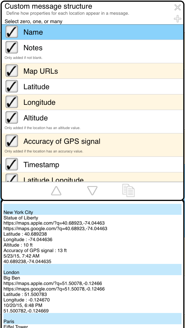
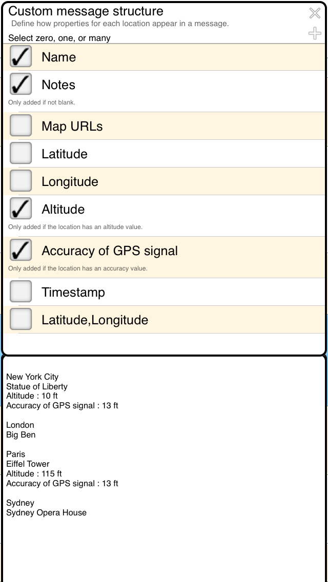
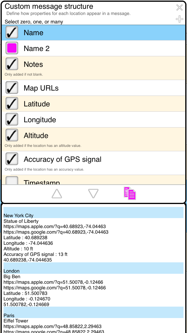
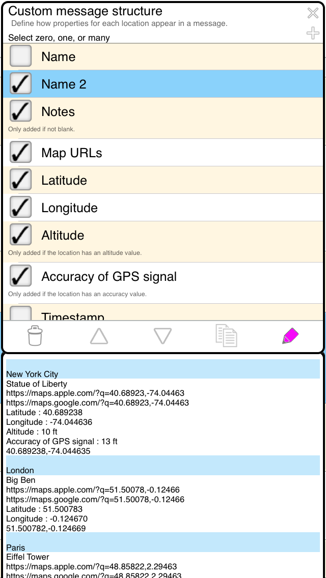
Conditional statements that depend on name, notes, altitude, and accuracy.
| structure string | description |
| <ifHasName: | if 'name' field in non-empty |
| <ifHasNotes: | if 'notes' field in non-empty |
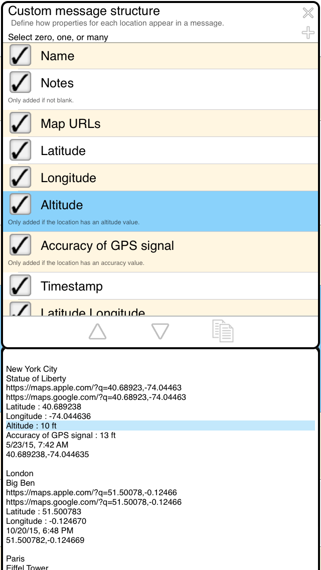
| <iHasAltitude: | if location has an altitude value |
| <ifHasAccuracy: | if location has an accuracy value |
All of your locations may not have all of these values...
Example uses:
| structure string | description |
| <ifHasName:<name> > | if 'name' field is non-empty, put 'name' here and make a new line. That is, do not add the new line if there is no name. |
| <ifHasNotes:<notes> > | if 'notes' field in non-empty, put 'notes' here and make a new line. That is, do not add the new line if there are no notes. |
| <iHasAltitude:<altMyFormat> > | if location's altitude value is invalid, don't let <altMyFormat> write '--- meters' for example. Otherwise, let it write '89 meters' and append a new line |
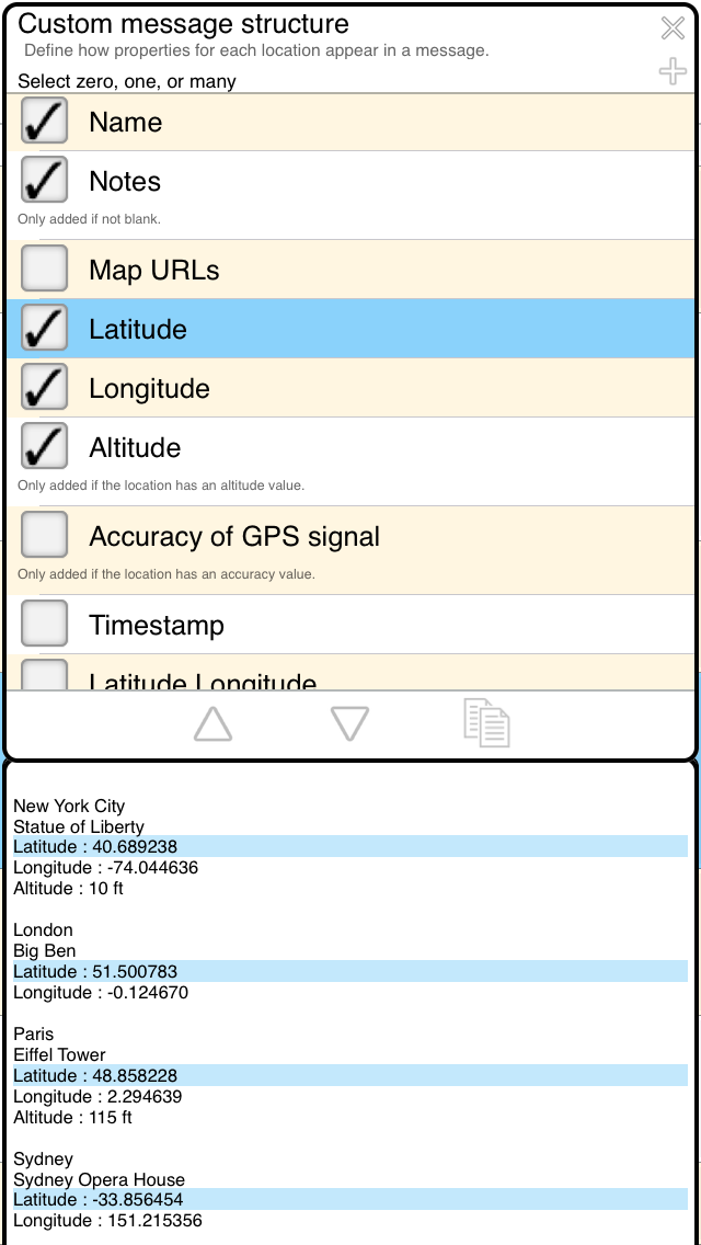
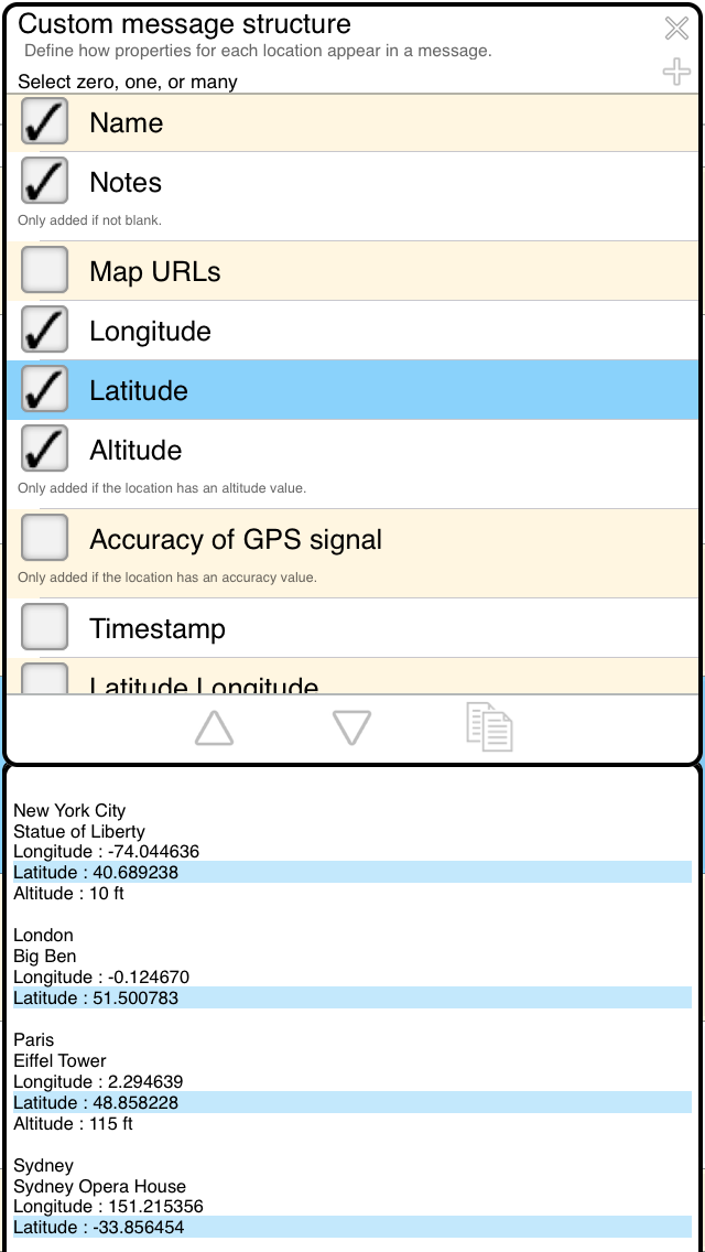
Conditional statements that depend on latitude & longitude.
Below, DD.dd represents latitude or longitude degrees. It is a signed decimal number.| tag | description |
| <ifLatGreaterThanDD.dd: | if latitude is greater than |
| <ifLatLessThanDD.dd: | if latitude is less than |
| <ifLonGreaterThanDD.dd: | if longitude is greater than |
| <ifLonLessThanDD.dd: | if longitude is less than |
| tag | description |
| <ifLatPositive: | if latitude >= 0 (Northern Hemisphere) |
| <ifLatNegative: | if latitude < 0 (Southern Hemisphere) |
| <ifLonPositive: | if longitude >= 0 (Eastern Hemisphere) |
| <ifLonNegative: | if longitude < 0 (Western Hemisphere) |
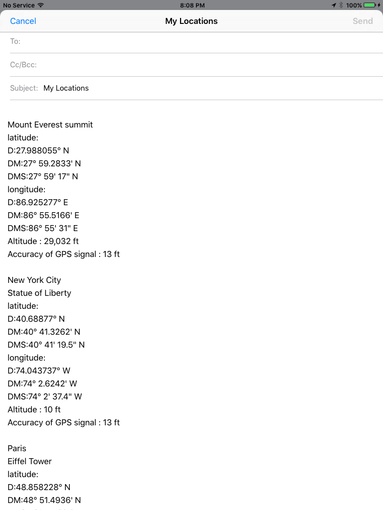
Another example using some tags from map URL strings:
latitude:
D:<latDegrees6ABS>° <ifLatPositive:N><ifLatNegative:S>
DM:<latDegrees0ABS>° <latMinutes4>' <ifLatPositive:N><ifLatNegative:S>
DMS:<latDegrees0ABS>° <latMinutes0>' <latSeconds1>" <ifLatPositive:N><ifLatNegative:S>
longitude:
D:<lonDegrees6ABS>° <ifLonPositive:E><ifLonNegative:W>
DM:<lonDegrees0ABS>° <lonMinutes4>' <ifLonPositive:E><ifLonNegative:W>
DMS:<lonDegrees0ABS>° <lonMinutes0>' <lonSeconds1>" <ifLonPositive:E><ifLonNegative:W>


All 'tags' discussed above are not case sensitive.
Contact
Email: kevinwillett80@yahoo.comPlease include 'My GPS Coordinates (Apple) messageStructure' in the subject.
back